Preparing
LoadingPreparing
Loading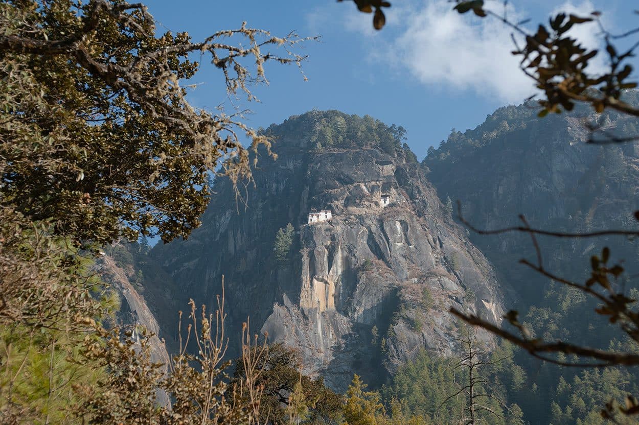
The answer for travellers wondering whether they can do the climb
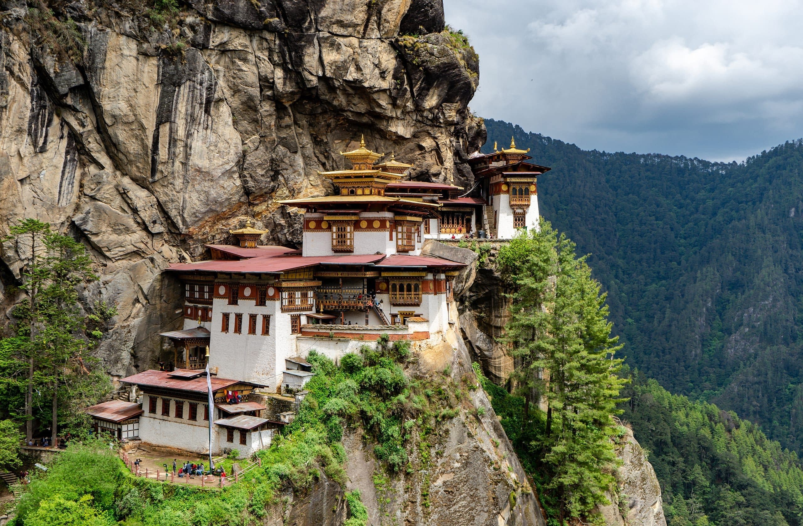
Tiger's Nest (Paro Taktsang) is the most-photographed monument in Bhutan and the climb every visitor weighs. The honest answer: moderately demanding, doable for most travellers in reasonable fitness, but not negligible — the trail gains roughly 700 metres of altitude on switchbacks to a maximum of 3,120 metres. Below: the actual numbers, the practical options for each ability level, and how to know whether the climb is right for you.
The short answer
Tiger's Nest is a 3-6 hour round-trip climb with ~700m altitude gain to a maximum of 3,120m on a graded switchback trail. Doable for most travellers in reasonable fitness; demanding for travellers in their 70s, with cardiopulmonary conditions, or unaccustomed to high altitude. A halfway cafeteria provides a clean turnaround point for travellers who want the photograph + the substantial look without the full climb. Most travellers do reach the temple; some don't, and there is no failure in stopping at the cafeteria.
Trailhead altitude: 2,580 metres above sea level (the car park at the base of the Paro valley wall). Tiger's Nest (Paro Taktsang) altitude: 3,120 metres above sea level. Total altitude gain: approximately 540-700 metres depending on the specific route variant (the standard trail vs the shorter steep alternative). Total walking distance: approximately 4 km each way (8 km total round-trip). Walking time: 2-3 hours up at a normal pace (faster for fit walkers at sea-level fitness; slower for travellers acclimatising to altitude). 1-2 hours down. Total: 4-6 hours including the temple visit. Trail surface: graded packed-earth switchbacks, with substantial stone-step sections near the top. The trail is well-maintained and safe; the risk is altitude exposure and fatigue, not the terrain. Stages: - 0 to ~1.5 hours: ascent through the pine forest to the halfway cafeteria (Taktsang Cafeteria) at approximately 2,940m - ~1.5 to ~2.5 hours: ascent from the cafeteria to the viewing platform (3,050m) — the best-photographed angle of the temple - ~2.5 to ~3 hours: descent from the viewing platform across the prayer-wheel ravine and final ascent to the temple complex itself at 3,120m
Most travellers in reasonable fitness can do the full climb. The demographic that completes the full climb without significant difficulty: - Travellers in their 30s-50s who walk regularly (3+ hours per week of moderate exercise — walking, light hiking, gym work) and have no cardiopulmonary conditions - Travellers in their 60s in good health with recent hiking experience (hill walking, moderate trekking history within the last 1-2 years) - Athletic travellers in their 70s who maintain fitness — rare but documented - Children 10 and older in good fitness, walking with parent or guide - Pregnant travellers in the first trimester (with medical clearance); not recommended in the second or third trimester The pace matters more than the fitness baseline. The matched knowledgeable guide adjusts the pace to the slowest walker in the group. Most travellers who climb at the guide's recommended pace (slow, with frequent water-and-photo stops) complete the climb.
The demographics that should skip the full climb: - Travellers in their 70s and 80s with any cardiopulmonary conditions. The altitude (3,120m) + the sustained effort (4-6 hours) + the switchback terrain are cumulatively demanding. - Travellers with heart conditions, COPD, asthma, or other respiratory conditions. Medical clearance required; trip-specific risk assessment with the matched guide. - Travellers with mobility issues — knee replacements, hip replacements, arthritis affecting weight-bearing. The switchback descent is the hardest part on the knees. - Travellers under 8 years old — too long, too altitude-exposed for most. - Pregnant travellers in the second or third trimester — not recommended; altitude exposure adds risk. - Travellers who have flown in within the last 48 hours and are still acclimatising — give the body 2-3 days at the Paro 2,250m baseline before the climb. The standard 7-night itinerary places the climb on Day 6 or 7 after acclimatisation. For these demographics, the base-of-climb option (below) delivers the photograph + the look at the temple without the climb.
For travellers who cannot or choose not to do the full climb, the base-of-climb option delivers most of the Tiger's Nest experience: The viewing platform at the trailhead: A 15-minute walk from the car park brings the visitor to the principal photographic viewpoint of the temple — the angle most photographs use. The temple is visible across the valley wall, perched on the cliff. The walk is flat-to-gentle, accessible to almost all visitors including the elderly and the mobility-limited. Lunch at the Taktsang Cafeteria: The halfway cafeteria (1-1.5 hours' walk up from the trailhead) serves lunch from ~11am to ~2pm. The cafeteria is accessible from the trailhead via a gentler trail variant (the 'easy' option — still ~1 hour walk on switchbacks but less steep). The view from the cafeteria across to the temple is excellent — many travellers choose the cafeteria turnaround as their endpoint. Combined family-trip framework: For multigenerational family trips (grandparents + parents + children), the standard pattern: the climbing-age family members walk the full climb with the matched guide; the grandparents and younger children take the base-of-climb walk to the viewing platform, lunch at the cafeteria, and the family reconverges by mid-afternoon. See bhutan-for-families-with-elderly-parents for the journey framework.
The Tiger's Nest climb tops out at 3,120 metres — above the 2,500m threshold where some travellers experience mild altitude symptoms (headache, nausea, shortness of breath, fatigue). The Paro valley baseline at 2,250m + the Dochu La pass at 3,100m (encountered on the Thimphu-Punakha drive) expose most visitors to altitude before the Tiger's Nest day. Most travellers in a standard 7-night Bhutan itinerary are acclimatised by the Tiger's Nest day. The matched guide carries an oxygen canister and monitors visitors' altitude response throughout the climb. Travellers with substantial altitude history — previous serious altitude sickness, Himalayan trekking with altitude issues, cardiopulmonary conditions — should discuss the specific risk with the matched guide before the climb. Diamox prophylaxis is medically available; discuss with your personal physician before the trip. Travellers from sea-level cities who have never been above 2,000m should plan for the standard 7-night Bhutan itinerary that builds altitude exposure gradually (Paro 2,250m → Thimphu 2,320m → Dochu La pass 3,100m on the drive → Punakha 1,280m → return to Paro for Tiger's Nest at 3,120m). The 5-7 days of gradual altitude exposure prepares the body for the Tiger's Nest day.
What to wear: layered clothing — Bhutan's mountain weather varies through the day. Thermal base layer + mid-layer fleece + shell jacket. Long trousers (shorts not appropriate for the temple visit). Supportive walking shoes or light hiking boots — not sneakers. Sun hat + sunglasses (altitude UV is substantial). What to carry: minimum 1.5 litres of water per person; light snack (energy bar or fruit); sunscreen; light rain jacket (weather changes); walking stick optional but recommended for the descent (available for rental at the trailhead). What to leave behind: heavy camera gear (matched guide carries the day pack with water; own camera should be light); jewellery and valuables (left at the lodge); sandals (trail demands proper walking shoes). What the temple requires: shoes removed at the temple entry; hats removed; long trousers / skirts below the knee; shoulders covered; no photography inside the principal chapels (permitted in the outer courtyards and from the viewing platform). Timing: most groups start the climb by 8:30 am to reach the viewing platform by 11:30 am - 12:00 pm and the temple by 12:30 pm. The descent to the trailhead by 4:00 pm. Lunch at the Taktsang Cafeteria on the descent.
Is the trail well-marked? Yes — single well-defined trail with markers throughout. Matched guide accompanies the climb. Are there toilets along the trail? Yes — at the Taktsang Cafeteria (halfway). No facilities between the cafeteria and the temple complex. Can I do the climb in the rain? The trail becomes slippery in heavy rain. The light rain is manageable; heavy rain is cause to reschedule (most standard itineraries build the Tiger's Nest day with a backup day in case of weather). Can I do the climb in winter? Yes — winter (December-February) is one of the best windows for the climb (clear skies, cold but crisp). Snow can occur at the top in deep winter (January-February); matched guide reads the day's conditions. Are there pony / horse rides? Yes — ponies are available at the trailhead for the ascent (not the descent — ponies do not walk down). Cost ~USD 30-50 per pony. Useful for travellers with mobility limitations who still want to reach the viewing platform or the cafeteria. Ponies do not go to the temple complex itself. Do I need a permit? Yes — included in the standard licensed-operator booking. The matched guide manages the permit at the trailhead. Photography? Permitted on the trail, at the viewing platform, in the outer courtyards. Prohibited in the principal chapels and the innermost sanctuary.
Practical
Common questions
We do not have published official statistics. From our operational experience: ~85-90% of climbing-age visitors who start the climb complete the climb to the temple. Around 5-10% turn around at the viewing platform or the cafeteria. The remaining 3-5% skip the climb entirely (grandparents and less-able family members). The climbing-age completion rate is high because most premium-tier visitors arrive in reasonable fitness.
The matched guide carries an oxygen canister and monitors the visitor throughout. Mild altitude symptoms (headache, shortness of breath) are addressed by slowing down, water, and rest. Moderate symptoms prompt turnaround back to the cafeteria or the trailhead — descent the treatment for altitude sickness. Serious altitude sickness is rare at 3,120m but possible — the matched guide manages the descent and the lodge concierge arranges follow-up medical care at the JDWNRH hospital in Thimphu if required.
No — no helicopter access to the temple itself (no landing zone at the cliff site). No vehicle access beyond the trailhead. The ascent and the descent are both on the same trail. Ponies are available for the ascent only (ponies do not descent the switchbacks).
Three levels of Tiger's Nest engagement: (1) The viewing platform at the trailhead — 15-minute walk, accessible to all visitors; photograph + look at the temple. (2) The Taktsang Cafeteria — 1-1.5 hours' walk, significant climb but easier than the full ascent; lunch and better photographic angle. (3) The full climb to the temple — 4-6 hours, demanding but doable for most reasonably-fit visitors.
The standard 7-night Bhutan itinerary builds a backup day for the Tiger's Nest climb. Heavy rain or snow that makes the trail unsafe prompts rescheduling to the backup day. The matched guide reads the weather and the trail each morning and communicates the plan.
For most reasonably-fit travellers, no specific training required beyond normal exercise routine. For travellers who don't currently walk regularly, 4-6 weeks of preparation (30-60 minute walks 3-4 times per week, with some hills or stair work) substantially improves the comfort of the climb. For older travellers, medical clearance and structured walking program for 8-12 weeks before the trip recommended.
Journeys it informs
Journey
A private seven-night Bhutan honeymoon for couples flying from Singapore. Bhutanese lodges, a matched guide, transparent all-inclusive pricing.
Journey
An eight-night Bhutan journey paced for elderly parents and their adult children. Luxury tier, low-altitude pacing, ground-floor villas, optional Tiger's Nest.
Journey
A seven-night Bhutan photography journey in October — Bhutan, golden-hour access at Punakha Dzong, a tripod-friendly guide, and transparent pricing.
Five questions. A bespoke draft back within a day or two.